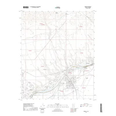
2018 Map of Parker
USGS Topo · Published 2018About this map
Parker and the surrounding riverfront communities define this reach of the Colorado River along the Arizona-California border. This modern survey illustrates the complex water management infrastructure essential to the region, including the Colorado River Aqueduct, which enters the area through the Whipple Mountain Tunnel, and an extensive network of irrigation features like the Main Canal and Lateral Nineteen R serving the Parker Valley. Across the river in California, the settlements of Earp and Big River sit against the eastern edge of the Mojave Desert, while the rugged heights of the Whipple Mountains dominate the northern skyline. The map captures a landscape shaped by transportation and recreation, from the runways of Avi Suquilla Airport to the established residential grids of Bluewater and the numerous roads, such as Parker Dam Rd, that follow the winding riverbanks.
Find a feature on this map
153 named features on this map. Tap any name to fly to it.
Don’t see what you’re looking for? This feature index may not catch every label — zoom into the map to look around manually.
Map Details
Editions of this 2018 Parker Map
This is the sole edition of this map. No revisions or reprints were ever made.
Other maps of this area

1911 · Parker
USGS Topo · 1:125,000

1943 · Giers Basin
USGS Topo · 1:62,500

1943 · Whipple Mts.
USGS Topo · 1:62,500

1943 · Parker
USGS Topo · 1:62,500

1949 · Parker
USGS Topo · 1:62,500

1950 · Parker Dam Area
USGS Topo · 1:62,500

1950 · Parker
USGS Topo · 1:62,500

1950 · Whipple Mts
USGS Topo · 1:62,500

1952 · Whipple Mts
USGS Topo · 1:62,500

1954 · Needles
USGS Topo · 1:250,000