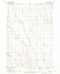
1968 Map of Parker NE
USGS Topo · Published 1971About this map
The East Fork Vermillion River and West Fork Vermillion River converge just south of Parker in this late-1960s survey of the Turner and Minnehaha county lines. The landscape is defined by a grid of rural schoolhouses and cemeteries, reflecting the distributed agrarian community of the era. Educational landmarks like Rocky Ridge Sch, Sletten Sch, Germantown Sch, and Stanford Sch are spaced across the townships of Brothersfield, Home, and Germantown.
Find a feature on this map
22 named features on this map. Tap any name to fly to it.
Don’t see what you’re looking for? This feature index may not catch every label — zoom into the map to look around manually.
Map Details
Editions of this 1968 Parker NE Map
This is the sole edition of this map. No revisions or reprints were ever made.
Other maps of this area

1897 · Canton
USGS Topo · 1:125,000

1898 · Parker
USGS Topo · 1:125,000

1900 · Canton
USGS Topo · 1:125,000

1955 · Sioux Falls
USGS Topo · 1:250,000

1958 · Sioux Falls
USGS Topo · 1:250,000

1962 · Hartford South
USGS Topo · 1:24,000

1962 · Lennox NW
USGS Topo · 1:24,000

1964 · Grass Lake
USGS Topo · 1:24,000

1964 · Lennox
USGS Topo · 1:24,000

1964 · East Vermillion Lake
USGS Topo · 1:24,000