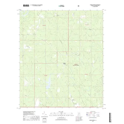
2018 Map of Parker Springs
USGS Topo · Published 2018About this map
Conecuh National Forest dominates the landscape of southern Escambia County in this late 2010s survey, where the small community of Parker Springs sits at a junction of rural roads. The area is defined by a dense network of watercourses, including the winding Conecuh River and numerous tributaries such as Wagon Body Br and Sweetwater Cr. Historically significant sites for genealogists include several family-named burial grounds like Sam McGowin Cem and the Mancil Cem, along with the Rock Creek Church Cem near the southern boundary. To the southwest, Leon Brooks Hines Lake provides a major water feature in a terrain otherwise characterized by sandy hills and small branches. The map also records early regional transportation routes like the Dixie Hwy, which runs through the northeastern corner, and unique landmarks such as Brackens Ditch.
Find a feature on this map
55 named features on this map. Tap any name to fly to it.
Don’t see what you’re looking for? This feature index may not catch every label — zoom into the map to look around manually.
Map Details
Editions of this 2018 Parker Springs Map
This is the sole edition of this map. No revisions or reprints were ever made.
Other maps of this area

1948 · Munson
USGS Topo · 1:62,500

1949 · Crestview
USGS Topo · 1:62,500

1950 · Munson
USGS Topo · 1:62,500

1951 · Crestview
USGS Topo · 1:62,500

1953 · Andalusia
USGS Topo · 1:250,000

1957 · Andalusia
USGS Topo · 1:250,000

1957 · Pensacola
USGS Topo · 1:250,000

1959 · Pensacola
USGS Topo · 1:250,000

1960 · Pensacola
USGS Topo · 1:250,000

1971 · Dixie
USGS Topo · 1:24,000