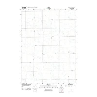
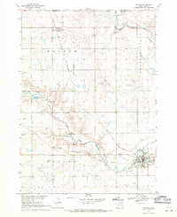
2012 Map of Parker SW
USGS Topo · Published 2012About this map
Hurley Cr meanders across the northern reaches of this Turner County landscape, a rural expanse defined by the rigid grid of the American township and range system. This 2012 survey documents the agricultural character of South Dakota as it stood at the start of the second decade of the millennium. The terrain is marked by essential local landmarks including Bethany Cem and Zion Cem, which serve as significant touchpoints for genealogical research in this prairie region. To the south, the waters of Turkey Ridge Cr flow through the territory, following the natural contours of the land beneath a network of section-line roads like 282nd St and 450th Ave. The map provides a precise layout of the rural infrastructure connecting disparate farmsteads and local drainage patterns.
Find a feature on this map
19 named features on this map. Tap any name to fly to it.
Don’t see what you’re looking for? This feature index may not catch every label — zoom into the map to look around manually.
Map Details
Editions of this 2012 Parker SW Map
This is the sole edition of this map. No revisions or reprints were ever made.
Other maps of this area

1898 · Parker
USGS Topo · 1:125,000

1955 · Sioux Falls
USGS Topo · 1:250,000

1958 · Sioux Falls
USGS Topo · 1:250,000
1968 · Parker NE
USGS Topo · 1:24,000
1968 · Hurley
USGS Topo · 1:24,000

1968 · Parker SW
USGS Topo · 1:24,000
1968 · Viborg
USGS Topo · 1:24,000
1968 · Parker
USGS Topo · 1:24,000

1970 · Turkey Ridge
USGS Topo · 1:24,000

1970 · Freeman SE
USGS Topo · 1:24,000
Featured Places
- Marion Township, SD
- Spring Valley Township, SD
- Parker Township, SD
- Swan Lake Township, SD
- Hurley Township, SD