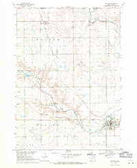
1968 Map of Parker
USGS Topo · Published 1971About this map
The confluence of the West Fork Vermillion River and the East Fork Vermillion River defines the landscape of southeastern South Dakota in the late 1960s. The city of Parker serves as a local hub, situated at the intersection of the Chicago Milwaukee St Paul and Pacific and the Chicago and North Western railroads. These rail lines were central to the agricultural economy, connecting the small settlement of Monroe and the surrounding townships of Monroe, Brothersfield, and Marion.
Find a feature on this map
23 named features on this map. Tap any name to fly to it.
Don’t see what you’re looking for? This feature index may not catch every label — zoom into the map to look around manually.
Map Details
Editions of this 1968 Parker Map
This is the sole edition of this map. No revisions or reprints were ever made.
Other maps of this area

1898 · Parker
USGS Topo · 1:125,000

1955 · Sioux Falls
USGS Topo · 1:250,000

1958 · Sioux Falls
USGS Topo · 1:250,000

1964 · Grass Lake
USGS Topo · 1:24,000

1964 · Canistota
USGS Topo · 1:24,000

1964 · East Vermillion Lake
USGS Topo · 1:24,000
1968 · Parker NE
USGS Topo · 1:24,000
1968 · Hurley
USGS Topo · 1:24,000

1968 · Parker SW
USGS Topo · 1:24,000

1970 · Freeman SE
USGS Topo · 1:24,000