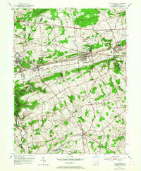
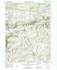
1953 Map of Parkesburg
USGS Topo · Published 1967About this map
The Pennsylvania Railroad corridor serves as the industrial and social spine of this landscape, connecting towns like Parkesburg and Atglen during the mid-1950s. The map illustrates a dense network of early transportation routes, including the Lincoln Highway and Strasburg Road, which skirt the northern edges of the Chester Valley. These roads and rails link established villages and smaller hamlets such as Sadsburyville, Lenover, and Pomeroy.
Find a feature on this map
53 named features on this map. Tap any name to fly to it.
Don’t see what you’re looking for? This feature index may not catch every label — zoom into the map to look around manually.
Map Details
Editions of this 1953 Parkesburg Map
5 editions found
Other maps of this area

1904 · Coatesville
USGS Topo · 1:62,500

1905 · Honey Brook
USGS Topo · 1:62,500

1906 · Coatesville
USGS Topo · 1:62,500

1906 · New Holland
USGS Topo · 1:62,500

1907 · Honeybrook
USGS Topo · 1:62,500

1908 · New Holland
USGS Topo · 1:62,500

1912 · Quarryville
USGS Topo · 1:62,500

1918 · Coatesville
USGS Topo · 1:62,500

1941 · Honeybrook
USGS Topo · 1:62,500

1941 · New Holland
USGS Topo · 1:62,500