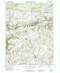
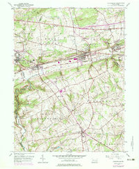
1953 Map of Parkesburg
USGS Topo · Published 1992About this map
The Penn Central rail corridor dictates the settlement pattern of this rural corridor, anchoring a string of boroughs including Christiana, Atglen, and Parkesburg. To the north, the Lincoln Highway passes through Sadsburyville, while the Strasburg Road winds through W E S T S A D S B U R Y, illustrating the shift from early turnpike travel to industrial rail reliance. The map reveals the deep Quaker and community roots of the area, marked by the Sadsbury Meeting House and Zion Hill Ch.
Find a feature on this map
61 named features on this map. Tap any name to fly to it.
Don’t see what you’re looking for? This feature index may not catch every label — zoom into the map to look around manually.
Map Details
Editions of this 1953 Parkesburg Map
5 editions found
Other maps of this area

1904 · Coatesville
USGS Topo · 1:62,500

1905 · Honey Brook
USGS Topo · 1:62,500

1906 · Coatesville
USGS Topo · 1:62,500

1906 · New Holland
USGS Topo · 1:62,500

1907 · Honeybrook
USGS Topo · 1:62,500

1908 · New Holland
USGS Topo · 1:62,500

1912 · Quarryville
USGS Topo · 1:62,500

1918 · Coatesville
USGS Topo · 1:62,500

1941 · Honeybrook
USGS Topo · 1:62,500

1941 · New Holland
USGS Topo · 1:62,500