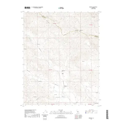
2018 Map of Parkfield
USGS Topo · Published 2018About this map
Parkfield sits at the heart of this landscape, a settlement famously defined by its proximity to the San Andreas Fault, which cuts a distinct diagonal path through the terrain. The map details the rugged intersection of the Diablo Range and the Cholame Hills, where elevations rise toward Mustang Peak and Mine Mtn. This area in southern Monterey County is a network of deep drainage systems, including Joaquin Canyon, Lang Canyon, and the winding course of Little Cholame Cr.
Find a feature on this map
35 named features on this map. Tap any name to fly to it.
Don’t see what you’re looking for? This feature index may not catch every label — zoom into the map to look around manually.
Map Details
Editions of this 2018 Parkfield Map
This is the sole edition of this map. No revisions or reprints were ever made.
Other maps of this area

1912 · Coalinga
USGS Topo · 1:125,000

1914 · Cholame
USGS Topo · 1:125,000

1915 · Priest Valley
USGS Topo · 1:125,000

1915 · Cholame
USGS Topo · 1:125,000

1917 · Cholame
USGS Topo · 1:125,000

1919 · San Miguel
USGS Topo · 1:62,500

1934 · The Dark Hole
USGS Topo · 1:31,680

1936 · Kreyenhagen Hills
USGS Topo · 1:31,680
1937 · The Dark Hole
USGS Topo · 1:31,680
1941 · Kreyenhagen Hills
USGS Topo · 1:31,680