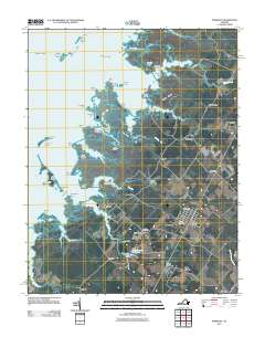
2011 Map of Parksley
USGS Topo · Published 2011About this map
Parksley serves as the inland anchor for this 2011 survey of the Eastern Shore of Virginia, where established agricultural and rail-oriented settlements transition into a complex network of coastal marshes and tidal guts. The landscape is defined by the contrast between the organized street grids of towns like Whitesville and Bloxom and the erratic labyrinth of Beasley Bay to the west. Local genealogy and industry are marked by sites such as the Liberty Cemetery and the Drummonds Millpond Dam at The Oaks. The coastal fringe is a mosaic of family-named points and islands, including Peters Point, Jacks Island, and Jobes Island, reflecting a long history of maritime activity. Small hamlets like Lee Mont and Justisville are linked by rural routes that trace the higher ground of Bailey Ridge and The Ridge, providing a clear view of the habitation patterns in Accomack County before the marshlands take over.
Find a feature on this map
67 named features on this map. Tap any name to fly to it.
Don’t see what you’re looking for? This feature index may not catch every label — zoom into the map to look around manually.
Map Details
Editions of this 2011 Parksley Map
This is the sole edition of this map. No revisions or reprints were ever made.
Other maps of this area

1903 · Crisfield
USGS Topo · 1:62,500

1920 · Crisfield
USGS Topo · 1:62,500

1931 · Accomac
USGS Topo · 1:48,000

1935 · Accomac
USGS Topo · 1:62,500

1942 · Chesconessex
USGS Topo · 1:31,680

1942 · Mappsville
USGS Topo · 1:24,000

1942 · Saxis
USGS Topo · 1:24,000

1942 · Parksley
USGS Topo · 1:24,000

1943 · Pungoteague
USGS Topo · 1:31,680

1943 · Parksley
USGS Topo · 1:31,680