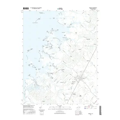
2016 Map of Parksley
USGS Topo · Published 2016About this map
Parksley serves as a central hub on Virginia's Eastern Shore, surrounded by a constellation of smaller settlements like Whitesville, Lee Mont, and Hopeton. The landscape is a intricate network of saltwater estuaries and marshlands, where Beasley Bay and Chesapeake Bay meet the shoreline at Guard Shore and Annis Point. The interior terrain is defined by low-lying drainages such as Cattail Cr, Coards Branch, and the Drummonds Millpond area, indicating a history of water management and milling in this coastal plain. Cultural markers are prominent, with several burial grounds including Liberty Cem and the Abrams Family Cem providing essential points of reference for local family history. From the waterfront at Peters Point to the small communities of Chase Crossing and High Woods, the map illustrates a rural society deeply connected to its coastal geography and small-town centers.
Find a feature on this map
145 named features on this map. Tap any name to fly to it.
Don’t see what you’re looking for? This feature index may not catch every label — zoom into the map to look around manually.
Map Details
Editions of this 2016 Parksley Map
This is the sole edition of this map. No revisions or reprints were ever made.
Other maps of this area

1903 · Crisfield
USGS Topo · 1:62,500

1920 · Crisfield
USGS Topo · 1:62,500

1931 · Accomac
USGS Topo · 1:48,000

1935 · Accomac
USGS Topo · 1:62,500

1942 · Chesconessex
USGS Topo · 1:31,680

1942 · Mappsville
USGS Topo · 1:24,000

1942 · Saxis
USGS Topo · 1:24,000

1942 · Parksley
USGS Topo · 1:24,000

1943 · Pungoteague
USGS Topo · 1:31,680

1943 · Parksley
USGS Topo · 1:31,680