
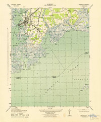
1943 Map of Parksley
USGS Topo · Published 1943About this map
Parksley serves as the focal point of this Eastern Shore survey, situated along the Pennsylvania railroad line. The settlement pattern reveals a series of small, interconnected villages like Whitesville, Lee Mont, and Hopeton that supported the local agricultural and maritime economy. To the west, the landscape transitions into the intricate wetlands of Byrds Marsh and The Thorofare, where numerous family-named landmarks such as Dix Hammock, Marks Island, and Webb Island define the shifting shoreline.
Find a feature on this map
110 named features on this map. Tap any name to fly to it.
Don’t see what you’re looking for? This feature index may not catch every label — zoom into the map to look around manually.
Map Details
Editions of this 1943 Parksley Map
This is the sole edition of this map. No revisions or reprints were ever made.
Other maps of this area

1903 · Crisfield
USGS Topo · 1:62,500

1920 · Crisfield
USGS Topo · 1:62,500

1931 · Accomac
USGS Topo · 1:48,000

1935 · Accomac
USGS Topo · 1:62,500

1942 · Chesconessex
USGS Topo · 1:31,680

1942 · Mappsville
USGS Topo · 1:24,000

1942 · Saxis
USGS Topo · 1:24,000

1942 · Parksley
USGS Topo · 1:24,000

1943 · Pungoteague
USGS Topo · 1:31,680
1943 · Crisfield
USGS Topo · 1:31,680