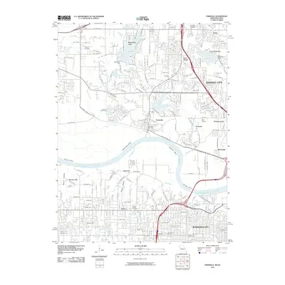
2010 Map of Parkville
USGS Topo · Published 2010About this map
The Missouri River defines the heart of this landscape, carving through deep bends like Little Platte Bend and Quindaro Bend. This 2010 survey shows the northern reaches of Kansas City as it transitions from dense residential blocks in Welborn to the hilltop communities of Parkville and Riverside. The terrain is characterized by numerous artificial impoundments, including Weatherby Lake, Lake Waukomis, and Riss Lake, which serve as focal points for suburban development.
Find a feature on this map
97 named features on this map. Tap any name to fly to it.
Don’t see what you’re looking for? This feature index may not catch every label — zoom into the map to look around manually.
Map Details
Editions of this 2010 Parkville Map
This is the sole edition of this map. No revisions or reprints were ever made.
Other maps of this area

1890 · Kansas City
USGS Topo · 1:125,000

1894 · Kansas City
USGS Topo · 1:125,000

1910 · Leavenworth
USGS Topo · 1:62,500

1914 · Smithville
USGS Topo · 1:62,500

1934 · Bonner Springs
USGS Topo · 1:48,000

1934 · Shawnee
USGS Topo · 1:24,000

1934 · Edwardsville
USGS Topo · 1:24,000

1934 · Wolcott
USGS Topo · 1:24,000

1935 · Kansas City
USGS Topo · 1:24,000

1935 · North Kansas City
USGS Topo · 1:24,000