
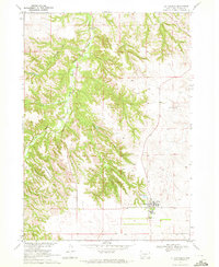
1969 Map of Parmelee
USGS Topo · Published 1971About this map
Parmelee serves as a central hub on this landscape, situated entirely within the Rosebud Indian Reservation during the late 1960s. The map highlights significant cultural and ancestral sites, specifically identifying High Hawks Village (Historic Site) and Hollow Horn Bear Village (Historic Site) south of the main settlement. These labels, along with the Hollow Horn Bear settlement, point to a geography deeply connected to specific families and tribal history.
Find a feature on this map
16 named features on this map. Tap any name to fly to it.
Don’t see what you’re looking for? This feature index may not catch every label — zoom into the map to look around manually.
Map Details
Editions of this 1969 Parmelee Map
This is the sole edition of this map. No revisions or reprints were ever made.
Other maps of this area

1955 · Martin
USGS Topo · 1:250,000

1958 · Martin
USGS Topo · 1:250,000

1969 · Norris
USGS Topo · 1:24,000

1969 · Eagle Mans Butte
USGS Topo · 1:24,000

1969 · Parmelee NE
USGS Topo · 1:24,000

1969 · Soldier Creek
USGS Topo · 1:24,000

1969 · Soldier Creek NW
USGS Topo · 1:24,000

1969 · Iron Shell Flat East
USGS Topo · 1:24,000

1969 · Iron Shell Flat West
USGS Topo · 1:24,000
1969 · St. Francis
USGS Topo · 1:24,000