
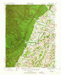
1944 Map of Parnassus
USGS Topo · Published 1955About this map
The dramatic limestone formations of Natural Chimneys stand as a central landmark in this 1944 survey of the Shenandoah Valley's western edge. While the eastern half of the map is defined by a dense network of farming communities like Mt Solon, Sangerville, and Centerville, the west rises sharply into the high ridges of the George Washington National Forest. This transition is anchored by the North River, which flows past recreation sites including Camp May Flather (Girl Scouts) and the North River Camp.
Find a feature on this map
87 named features on this map. Tap any name to fly to it.
Don’t see what you’re looking for? This feature index may not catch every label — zoom into the map to look around manually.
Map Details
Editions of this 1944 Parnassus Map
2 editions found
Other maps of this area

1892 · Franklin
USGS Topo · 1:125,000

1892 · Woodstock
USGS Topo · 1:125,000

1892 · Harrisonburg
USGS Topo · 1:125,000

1894 · Staunton
USGS Topo · 1:125,000

1896 · Franklin
USGS Topo · 1:125,000

1922 · Fort Seybert
USGS Topo · 1:48,000

1922 · Circleville
USGS Topo · 1:62,500

1924 · Circleville
USGS Topo · 1:48,000

1924 · Mc Dowell
USGS Topo · 1:62,500

1924 · Fort Seybert
USGS Topo · 1:62,500