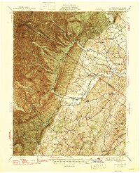
1947 Map of Parnassus
USGS Topo · Published 1947About this map
Natural Chimneys stands as a prominent geological landmark along the boundary of Rockingham and Augusta counties, marking the transition from the fertile river bottoms to the steep slopes of the Shenandoah Mountain range. This mid-century survey reveals a landscape defined by small valley settlements like Sangerville, Parnassus, and Mt Solon, which are connected by a network of winding roads and mountain gaps such as Briery Branch Gap and North River Gap.
Find a feature on this map
77 named features on this map. Tap any name to fly to it.
Don’t see what you’re looking for? This feature index may not catch every label — zoom into the map to look around manually.
Map Details
Editions of this 1947 Parnassus Map
2 editions found

Other maps of this area

1892 · Franklin
USGS Topo · 1:125,000

1892 · Woodstock
USGS Topo · 1:125,000

1892 · Harrisonburg
USGS Topo · 1:125,000

1894 · Staunton
USGS Topo · 1:125,000

1896 · Franklin
USGS Topo · 1:125,000

1922 · Fort Seybert
USGS Topo · 1:48,000

1922 · Circleville
USGS Topo · 1:62,500

1924 · Circleville
USGS Topo · 1:48,000

1924 · Mc Dowell
USGS Topo · 1:62,500

1924 · Fort Seybert
USGS Topo · 1:62,500