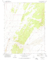
1971 Map of Parowan Gap
USGS Topo · Published 1975About this map
Petroglyphs near The Narrows mark the entrance to a natural geological corridor through the Red Hills in Iron County. This 1971 survey captures the arid landscape north of Cedar City, where the low-lying basin of Little Salt Lake defines the eastern edge of the Parowan Valley. The terrain is characterized by a network of drainage features like Jackrabbit Wash and Long Hollow, which cut through the uplifted ridges of Long Hill. Small-scale resource extraction is evident through scattered Prospects and a Borrow Pit near the gap. Water sources, vital in this desert environment, are documented at Lister Spring and Dipping Vat Spring, the latter suggesting historical livestock usage in the canyons. The map tracks several Jeep Trails that navigate the high ground between Coal Canyon and Whitney Canyon, providing a detailed view of the area's topography before modern development altered the valley floor.
Find a feature on this map
23 named features on this map. Tap any name to fly to it.
Don’t see what you’re looking for? This feature index may not catch every label — zoom into the map to look around manually.
Map Details
Editions of this 1971 Parowan Gap Map
This is the sole edition of this map. No revisions or reprints were ever made.
Other maps of this area

1885 · St. George
USGS Topo · 1:250,000

1885 · Beaver
USGS Topo · 1:250,000

1886 · Kanab
USGS Topo · 1:250,000

1891 · St. George
USGS Topo · 1:250,000

1950 · Enoch
USGS Topo · 1:24,000

1950 · Enoch
USGS Topo · 1:62,500

1950 · Enoch NE
USGS Topo · 1:24,000

1952 · Enoch NE
USGS Topo · 1:24,000

1953 · Richfield
USGS Topo · 1:250,000

1953 · Cedar City
USGS Topo · 1:250,000