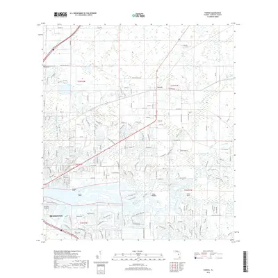
2018 Map of Parrish
USGS Topo · Published 2018About this map
The Manatee River anchors the southern portion of this 2018 survey, defining a landscape where riverfront developments meet the historically rural character of Manatee County. The community of Parrish serves as a central hub, surrounded by a complex network of drainage and transport infrastructure including the Buffalo Canal, Wade Canal, and Cedar Drain. These waterways, alongside features like Big Sawgrass and Little Sawgrass, highlight the hydrologic management required for both the agriculture and expanding residential footprints of the region. Near the river, Fort Hamer and Redfish Point mark significant transition points along the northern bank, while the Fortner Cem provides a point of genealogical interest north of Gamble Creek. The map effectively documents the transition of northern Bradenton as it moves from open spaces like Sand Prairie toward modern suburbanization.
Find a feature on this map
188 named features on this map. Tap any name to fly to it.
Don’t see what you’re looking for? This feature index may not catch every label — zoom into the map to look around manually.
Map Details
Editions of this 2018 Parrish Map
This is the sole edition of this map. No revisions or reprints were ever made.
Other maps of this area

1921 · Fort De Soto
USGS Topo · 1:62,500

1942 · Cockroach Bay
USGS Topo · 1:31,680

1944 · Ruskin
USGS Topo · 1:31,680

1944 · Rye
USGS Topo · 1:31,680

1944 · Wimauma
USGS Topo · 1:31,680

1944 · Verna
USGS Topo · 1:31,680

1944 · Lorraine
USGS Topo · 1:31,680

1944 · Ellenton
USGS Topo · 1:31,680

1944 · Parish
USGS Topo · 1:31,680

1945 · Cockroach Bay
USGS Topo · 1:31,680