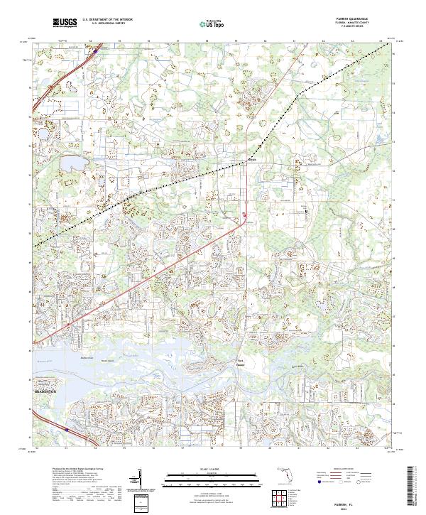
2024 Map of Parrish
USGS Topo · Published 2024About this map
Parrish serves as a central hub in this contemporary survey of Manatee County, illustrating the evolving intersection of historic landscape and modern suburban growth north of the Manatee River. The river corridor itself is a complex network of waterways and features, including Redfish Point, Marsh Island, and the bend known as Devils Elbow. Inland, the terrain is defined by significant drainage and wetland features like Big Sawgrass, Little Sawgrass, and Sand Prairie, alongside engineered waterways such as the Buffalo Canal and Wade Canal. For local historians and genealogists, the map preserves the location of Fortner Cem near Rutland Rd and identifies Fort Hamer, a site tied to the region's 19th-century military history. The extensive network of modern residential roads contrasts with the agricultural and hydrological foundations of the area, while the course of Gamble Creek remains a prominent natural boundary across the landscape.
Find a feature on this map
127 named features on this map. Tap any name to fly to it.
Don’t see what you’re looking for? This feature index may not catch every label — zoom into the map to look around manually.
Map Details
Editions of this 2024 Parrish Map
This is the sole edition of this map. No revisions or reprints were ever made.
Other maps of this area

1921 · Fort De Soto
USGS Topo · 1:62,500

1942 · Cockroach Bay
USGS Topo · 1:31,680

1944 · Ruskin
USGS Topo · 1:31,680

1944 · Rye
USGS Topo · 1:31,680

1944 · Wimauma
USGS Topo · 1:31,680

1944 · Verna
USGS Topo · 1:31,680

1944 · Lorraine
USGS Topo · 1:31,680

1944 · Ellenton
USGS Topo · 1:31,680

1944 · Parish
USGS Topo · 1:31,680

1945 · Cockroach Bay
USGS Topo · 1:31,680