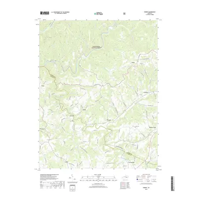
2019 Map of Parrot
USGS Topo · Published 2019About this map
The South Fork Rockcastle River and Middle Fork Rockcastle River wind through the dissected uplands of the Daniel Boone National Forest, defining the rugged border between Jackson and Laurel Counties. This landscape is marked by small upland settlements and family-oriented landmarks, such as Dabolt, Victory, and Peoples. The map provides significant genealogical value, documenting numerous remote burial grounds including Mount Zion Cem, Cornett Cem, and Lear Cem. A network of rural roads, such as Black Ridge Road and Old County Road, connects these isolated communities and follows the narrow ridges above the river valleys. The presence of the Sheltowee Trace NRT indicates the importance of long-distance trail systems through the central Kentucky forestlands, while local names like Moores Creek and Eberle point to established rural homesteads.
Find a feature on this map
102 named features on this map. Tap any name to fly to it.
Don’t see what you’re looking for? This feature index may not catch every label — zoom into the map to look around manually.
Map Details
Editions of this 2019 Parrot Map
This is the sole edition of this map. No revisions or reprints were ever made.
Other maps of this area

1891 · Manchester
USGS Topo · 1:125,000

1893 · London
USGS Topo · 1:125,000

1897 · London
USGS Topo · 1:125,000

1952 · Portersburg
USGS Topo · 1:24,000

1952 · Bernstadt
USGS Topo · 1:24,000

1952 · London
USGS Topo · 1:24,000

1953 · Johnetta
USGS Topo · 1:24,000

1953 · Mc Kee
USGS Topo · 1:24,000

1953 · Sandgap
USGS Topo · 1:24,000

1953 · Livingston
USGS Topo · 1:24,000