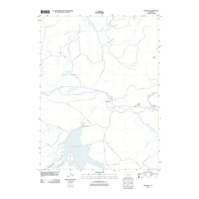
2010 Map of Parshall
USGS Topo · Published 2010About this map
Parshall serves as the central hub of this Grand County landscape, situated at the confluence where the Williams Fork meets the Colorado River. The geography is defined by significant water management infrastructure, most notably the Williams Fork Reservoir and its associated Williams Fork Dam, which dominates the southern half of the quadrangle. To the north, the Rock Creek Reservoir and Rock Creek Dam regulate the flow from Dry Gulch, while the Musgrave Ditch and Big Lake Ditch reveal the intricate network of irrigation vital to this high-altitude ranching and recreation area. The terrain rises sharply toward the east at Mount Bross, overlooking the narrow passage of Byers Canyon. Public land use is evident through the Colorado State Rifle Range and Gilbert Campground, providing a look at how the region's river valleys and canyons serve both utilitarian and leisure purposes in the early 21st century.
Find a feature on this map
43 named features on this map. Tap any name to fly to it.
Don’t see what you’re looking for? This feature index may not catch every label — zoom into the map to look around manually.
Map Details
Editions of this 2010 Parshall Map
This is the sole edition of this map. No revisions or reprints were ever made.
Other maps of this area

1933 · Mt. Powell
USGS Topo · 1:48,000

1933 · Ute Peak
USGS Topo · 1:62,500

1937 · Ute Peak
USGS Topo · 1:62,500

1940 · Mount Powell
USGS Topo · 1:62,500

1954 · Craig
USGS Topo · 1:250,000

1956 · Kremmling
USGS Topo · 1:62,500

1957 · Craig
USGS Topo · 1:250,000

1957 · Hot Sulphur Springs
USGS Topo · 1:62,500

1957 · Leadville
USGS Topo · 1:250,000

1958 · Craig
USGS Topo · 1:250,000