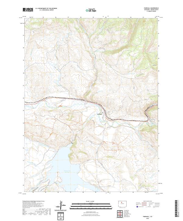
2022 Map of Parshall
USGS Topo · Published 2022About this map
Parshall sits at the vital junction of the Colorado River and the Williams Fork, a landscape defined by its complex irrigation network and significant water storage. The southern portion of the sheet is dominated by the expansive Williams Fork Reservoir, which captures the flow of Kinney Cr and Johnson Gulch. This modern survey reveals a highly managed alpine drainage system where historical water rights are represented by features like the Big Lake Ditch, Pheney Lateral Ditch, and Musgrave Ditch. To the north, the terrain rises toward Mt Bross, while the river narrows into the steep walls of Byers Canyon to the east. The map provides a precise record of rural Colorado infrastructure, documenting numerous county roads such as Co RD 36 and Co RD 214 that connect isolated reservoirs like Musgrave Reservoir and Rock Cr Reservoir across the high-altitude terrain.
Find a feature on this map
51 named features on this map. Tap any name to fly to it.
Don’t see what you’re looking for? This feature index may not catch every label — zoom into the map to look around manually.
Map Details
Editions of this 2022 Parshall Map
This is the sole edition of this map. No revisions or reprints were ever made.
Other maps of this area

1933 · Mt. Powell
USGS Topo · 1:48,000

1933 · Ute Peak
USGS Topo · 1:62,500

1937 · Ute Peak
USGS Topo · 1:62,500

1940 · Mount Powell
USGS Topo · 1:62,500

1954 · Craig
USGS Topo · 1:250,000

1956 · Kremmling
USGS Topo · 1:62,500

1957 · Craig
USGS Topo · 1:250,000

1957 · Hot Sulphur Springs
USGS Topo · 1:62,500

1957 · Leadville
USGS Topo · 1:250,000

1958 · Craig
USGS Topo · 1:250,000