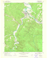
1968 Map of Parsons
USGS Topo · Published 1971About this map
The confluence of Shavers Fork and Black Fork creates the Cheat River at the town of Parsons, the geographic heart of this 1968 study. The Western Maryland railroad follows these river valleys, connecting the community of Bretz to the neighboring rail towns of Hambleton and Hendricks. This network underscores the importance of the river corridor for both transportation and industry, with a Quarry located near the rail line.
Find a feature on this map
67 named features on this map. Tap any name to fly to it.
Don’t see what you’re looking for? This feature index may not catch every label — zoom into the map to look around manually.
Map Details
Editions of this 1968 Parsons Map
2 editions found
Other maps of this area

1886 · St. George
USGS Topo · 1:125,000

1889 · Beverly
USGS Topo · 1:125,000

1891 · St. George
USGS Topo · 1:125,000

1892 · Beverly
USGS Topo · 1:125,000

1907 · Belington
USGS Topo · 1:62,500

1908 · Parsons
USGS Topo · 1:62,500

1909 · Elkins
USGS Topo · 1:62,500

1922 · Horton
USGS Topo · 1:48,000

1924 · Horton
USGS Topo · 1:62,500

1926 · Parsons
USGS Topo · 1:62,500