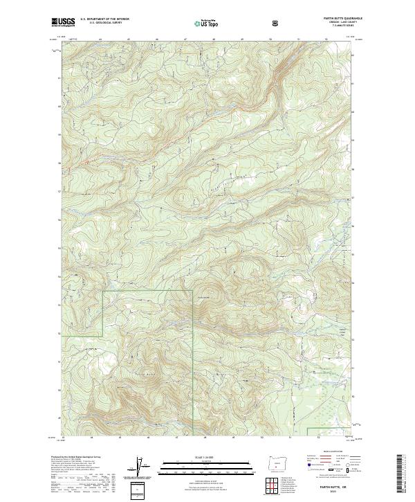
2023 Map of Partin Butte
USGS Topo · Published 2023About this map
Partin Butte and Round Butte dominate the landscape of Lake County in this modern 2023 survey, which details a high-elevation interior where water sources dictate the geography of the Fremont National Forest. The map traces a complex network of drainages including the West Fork Silver Creek and North Fork Silver Creek, which feed into the larger Silver Creek system. To the east, the terrain descends from the timbered heights of Alder Spring Ridge toward the open expanses of Thompson Valley and Indian Creek Flat. Land researchers will find specific points of interest such as Partin Spring and Alder Spring, reflecting the essential nature of reliable water in this part of Oregon. This detailed topographic study captures the contemporary boundaries and forest road networks that facilitate movement between the drainages of Bridge Creek and Coyote Creek.
Find a feature on this map
21 named features on this map. Tap any name to fly to it.
Don’t see what you’re looking for? This feature index may not catch every label — zoom into the map to look around manually.
Map Details
Editions of this 2023 Partin Butte Map
This is the sole edition of this map. No revisions or reprints were ever made.
Other maps of this area

1889 · Klamath
USGS Topo · 1:250,000

1894 · Klamath
USGS Topo · 1:250,000

1955 · Crescent
USGS Topo · 1:250,000

1955 · Klamath Falls
USGS Topo · 1:250,000

1957 · Crescent
USGS Topo · 1:250,000

1958 · Crescent
USGS Topo · 1:250,000

1958 · Klamath Falls
USGS Topo · 1:250,000

1960 · Sycan Marsh
USGS Topo · 1:62,500

1960 · Yamsay Mountain
USGS Topo · 1:62,500

1968 · Rodman Rock
USGS Topo · 1:24,000