
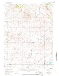
1958 Map of Parting of the Ways
USGS Topo · Published 1960About this map
The Continental Divide crests across the northern reaches of this high-desert landscape, where the paths of nineteenth-century westward expansion converge and split. At the famous Emigrant Trail (Parting of the Ways), travelers faced the critical choice between the Sublette Cutoff or continuing toward Fort Bridger. The map documents the enduring footprint of these migrations, showing the Lander Cutoff and the Lander Pinedale Stage Road traversing the drainages of Dry Sandy Creek and Pacific Creek.
Find a feature on this map
44 named features on this map. Tap any name to fly to it.
Don’t see what you’re looking for? This feature index may not catch every label — zoom into the map to look around manually.
Map Details
Editions of this 1958 Parting of the Ways Map
2 editions found
Other maps of this area

1953 · Christina Lake
USGS Topo · 1:24,000

1955 · Lander
USGS Topo · 1:250,000

1958 · Lander
USGS Topo · 1:250,000

1958 · Essex Mountain
USGS Topo · 1:62,500

1958 · Hay Meadow Reservoir
USGS Topo · 1:24,000

1958 · Tule Butte
USGS Topo · 1:24,000

1958 · Pacific Springs
USGS Topo · 1:24,000

1958 · Parting of the Ways
USGS Topo · 1:24,000

1958 · Freighter Gap
USGS Topo · 1:62,500

1961 · Lander
USGS Topo · 1:250,000