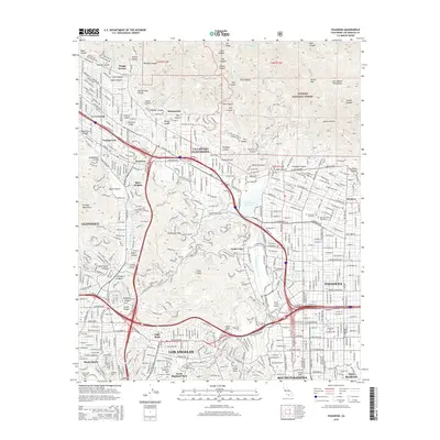
2015 Map of Pasadena
USGS Topo · Published 2015About this map
Pasadena and its neighboring communities sit at the foot of the Angeles National Forest, where the complex drainage systems of the San Rafael Hills and Verdugo Mountains meet the urban sprawl of Los Angeles County. This 2015 survey reveals the density of the northern San Gabriel Valley, showing the transition from the high ridges of Flint Peak and Poppy Peak down to established residential districts like Linda Vista and Altacanyada. The importance of water management is evident through features such as the Devils Gate Reservoir and the Arroyo Seco. Cultural and educational landmarks are prominent across the landscape, including Occidental College, Glendale Community College, and the sprawling grounds of Forest Lawn Memorial Park. The map also captures the distinct suburban boundaries of La Cañada Flintridge, Altadena, and South Pasadena, woven together by major corridors like Foothill Blvd and Colorado Blvd.
Find a feature on this map
94 named features on this map. Tap any name to fly to it.
Don’t see what you’re looking for? This feature index may not catch every label — zoom into the map to look around manually.
Map Details
Editions of this 2015 Pasadena Map
This is the sole edition of this map. No revisions or reprints were ever made.
Other maps of this area

1894 · Los Angeles
USGS Topo · 1:62,500

1896 · Pasadena
USGS Topo · 1:62,500

1896 · Santa Monica
USGS Topo · 1:62,500

1898 · Santa Monica
USGS Topo · 1:62,500

1900 · Pasadena
USGS Topo · 1:62,500

1900 · Tujunga
USGS Topo · 1:62,500

1900 · Los Angeles
USGS Topo · 1:62,500

1900 · Fernando
USGS Topo · 1:62,500

1901 · Southern California Sheet No. 1
USGS Topo · 1:250,000

1902 · Santa Monica
USGS Topo · 1:62,500