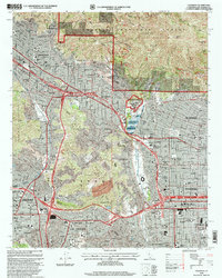
1995 Map of Pasadena
USGS Topo · Published 1999About this map
Pasadena and its neighboring San Gabriel Valley communities appear in high detail during the mid-1990s, showcasing a landscape defined by its world-renowned institutions and steep mountain borders. The Jet Propulsion Laboratory (California Institute of Technology) occupies the northern edge near the mouth of Arroyo Seco, while the Rose Bowl and the California Institute of Technology anchor the heart of the city. The map highlights the transition from the densely settled urban grid of Los Angeles and Glendale to the southern foothills of the Angeles National Forest. Notable for genealogists and local historians, it identifies numerous neighborhood institutions such as St Elizabeth Sch, Occidental College, and the sprawling Forest Lawn Memorial Park (Cem). The complex transportation network includes the Glendale Freeway and Pasadena Freeway, which navigate the folds of the San Rafael Hills and Verdugo Mountains.
Find a feature on this map
63 named features on this map. Tap any name to fly to it.
Don’t see what you’re looking for? This feature index may not catch every label — zoom into the map to look around manually.
Map Details
Editions of this 1995 Pasadena Map
This is the sole edition of this map. No revisions or reprints were ever made.
Other maps of this area

1894 · Los Angeles
USGS Topo · 1:62,500

1896 · Pasadena
USGS Topo · 1:62,500

1896 · Santa Monica
USGS Topo · 1:62,500

1898 · Santa Monica
USGS Topo · 1:62,500

1900 · Pasadena
USGS Topo · 1:62,500

1900 · Tujunga
USGS Topo · 1:62,500

1900 · Los Angeles
USGS Topo · 1:62,500

1900 · Fernando
USGS Topo · 1:62,500

1901 · Southern California Sheet No. 1
USGS Topo · 1:250,000

1902 · Santa Monica
USGS Topo · 1:62,500