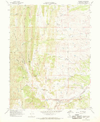
1967 Map of Paskenta
USGS Topo · Published 1969About this map
Paskenta anchors this late 1960s survey, situated along the northern banks of Thomes Creek where the foothills begin to rise into the eastern slope of the Coast Range. The landscape is defined by a series of parallel ridges and canyons, including High Flat Ridge and Blue Canyon, which drain into a network of seasonal and permanent watercourses like Elder Creek and McCarty Creek. A notable historical artifact is the Old Indian Treaty Boundary, which bisects the terrain diagonally, cutting across the rolling landscape of Nevada Bottom Creek.
Find a feature on this map
41 named features on this map. Tap any name to fly to it.
Don’t see what you’re looking for? This feature index may not catch every label — zoom into the map to look around manually.
Map Details
Editions of this 1967 Paskenta Map
2 editions found
Other maps of this area

1890 · Red Bluff
USGS Topo · 1:250,000

1894 · Red Bluff
USGS Topo · 1:250,000

1944 · Flournoy
USGS Topo · 1:62,500

1949 · Colyear Springs
USGS Topo · 1:62,500

1952 · Red Bank
USGS Topo · 1:24,000

1952 · Paskenta
USGS Topo · 1:62,500

1952 · Red Bank
USGS Topo · 1:62,500

1957 · Colyear Springs
USGS Topo · 1:62,500

1957 · Ukiah
USGS Topo · 1:250,000

1958 · Redding
USGS Topo · 1:250,000