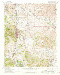
1961 Map of Paso Robles
USGS Topo · Published 1968About this map
The Salinas River corridor defines the geography of this mid-century survey, anchoring a network of small agricultural settlements and historic landmarks. The Mission San Miguel Arcangel stands near the northern boundary, marking the region's colonial heritage, while the town of Paso Robles serves as the central hub, situated just north of Capital Hill. The landscape is characterized by a transition from the river valley into several canyons, including Keyes Canyon and Ranchito Canyon, which drain into the Estrella River system to the northeast.
Find a feature on this map
51 named features on this map. Tap any name to fly to it.
Don’t see what you’re looking for? This feature index may not catch every label — zoom into the map to look around manually.
Map Details
Editions of this 1961 Paso Robles Map
2 editions found
Other maps of this area

1897 · San Luis Obispo
USGS Topo · 1:62,500

1897 · Cayucos
USGS Topo · 1:62,500

1900 · San Luis
USGS Topo · 1:125,000

1914 · Cholame
USGS Topo · 1:125,000

1915 · Cholame
USGS Topo · 1:125,000

1917 · Cholame
USGS Topo · 1:125,000

1919 · San Miguel
USGS Topo · 1:62,500

1919 · Paso Robles
USGS Topo · 1:62,500

1919 · Bradley
USGS Topo · 1:62,500

1919 · Adelaida
USGS Topo · 1:62,500