
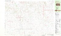
1951 Map of Pass Creek NE
USGS Topo · Published 1953About this map
The Pine Ridge Indian Reservation landscape is defined here by the intricate erosion patterns of the Red Stone Basin and the elevated expanse of Brown Flat. This 1951 field check reveals a high-plains environment where water is the primary geographic driver, marked by numerous small reservoirs such as Red Rock Pond, Corral Pond, and Badland Pond. These features, alongside Bowman Pond and Rock Hill Pond, indicate a landscape managed for livestock and seasonal water retention within the Missouri River Basin development program.
Find a feature on this map
19 named features on this map. Tap any name to fly to it.
Don’t see what you’re looking for? This feature index may not catch every label — zoom into the map to look around manually.
Map Details
Editions of this 1951 Pass Creek NE Map
This is the sole edition of this map. No revisions or reprints were ever made.
Other maps of this area

1951 · Pass Creek NW
USGS Topo · 1:24,000

1951 · Stamford SW
USGS Topo · 1:24,000

1951 · Belvidere
USGS Topo · 1:24,000

1951 · Belvidere SW
USGS Topo · 1:24,000

1951 · Cedar Butte NW
USGS Topo · 1:24,000

1955 · Martin
USGS Topo · 1:250,000

1958 · Martin
USGS Topo · 1:250,000

1980 · Kadoka
USGS Topo · 1:100,000

1981 · Cedar Butte
USGS Topo · 1:25,000
1981 · Short Bow Creek
USGS Topo · 1:25,000