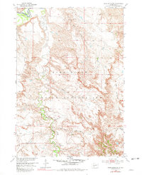
1951 Map of Pass Creek NW
USGS Topo · Published 1981About this map
The Pine Ridge Indian Reservation occupies the majority of this landscape in the mid-twentieth century, where the winding course of the White River defines the northwestern boundary between Jackson Co and Washabaugh Co. The terrain is characterized by the prominent Pine Ridge escarpment, giving way to the expansive Red Stone Basin to the south.
Find a feature on this map
13 named features on this map. Tap any name to fly to it.
Don’t see what you’re looking for? This feature index may not catch every label — zoom into the map to look around manually.
Map Details
Editions of this 1951 Pass Creek NW Map
2 editions found
Other maps of this area

1951 · Pass Creek NW
USGS Topo · 1:24,000

1951 · Belvidere
USGS Topo · 1:24,000

1951 · Kadoka
USGS Topo · 1:24,000

1951 · Belvidere SW
USGS Topo · 1:24,000

1951 · Wanblee NE
USGS Topo · 1:24,000

1951 · Pass Creek NE
USGS Topo · 1:24,000

1955 · Martin
USGS Topo · 1:250,000

1958 · Martin
USGS Topo · 1:250,000

1980 · Kadoka
USGS Topo · 1:100,000

1981 · Broken Leg Dam
USGS Topo · 1:24,000