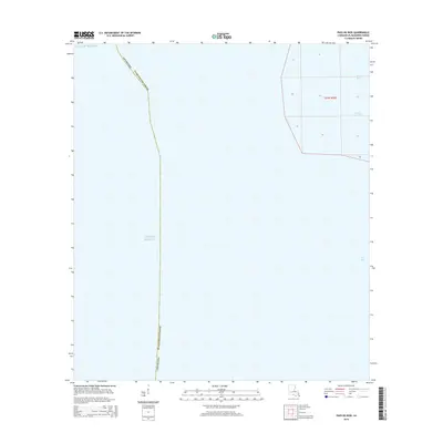
2015 Map of Pass du Bois
USGS Topo · Published 2015About this map
The coastal waters of Plaquemines Parish meet the Gulf of Mexico in this nautical landscape at the extreme southern edge of Louisiana. The map focuses on the hydrologic transitions within the Mississippi River Delta, where narrow waterways such as Pass Du Bois and Pass La Graisse cut through the marshy terrain. These passes are vital arteries for the local ecosystem and the maritime traffic of the region, leading toward the open expanse of West Bay. Most of the area is characterized by open water and shifting coastal boundaries, illustrating the dynamic nature of the Gulf Coast shoreline. The grid of Section 24 and Township 23 South, Range 30 East provides a structural framework for this otherwise fluid maritime environment.
Find a feature on this map
16 named features on this map. Tap any name to fly to it.
Don’t see what you’re looking for? This feature index may not catch every label — zoom into the map to look around manually.
Map Details
Editions of this 2015 Pass du Bois Map
This is the sole edition of this map. No revisions or reprints were ever made.
Other maps of this area

1893 · West Delta
USGS Topo · 1:62,500

1946 · Pass Du Bois
USGS Topo · 1:31,680

1946 · Mudpan Bayou
USGS Topo · 1:31,680

1946 · Pass Tante Phine
USGS Topo · 1:31,680

1947 · Southwest Pass
USGS Topo · 1:31,680

1949 · Cubits Gap
USGS Topo · 1:31,680
1949 · Burrwood
USGS Topo · 1:31,680

1952 · Southwest Pass
USGS Topo · 1:62,500

1953 · West Delta
USGS Topo · 1:62,500
1954 · Pass Du Bois
USGS Topo · 1:31,680