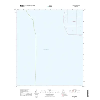
2020 Map of Pass du Bois
USGS Topo · Published 2020About this map
The coastal waters and tidal passes of Plaquemines Parish define this 2020 survey of the Mississippi River Delta's extreme edge. Dominated by the Gulf of Mexico, the area shows the intricate hydrography of the lower delta, where waterways like Pass-Du-Bois and Pass-La-Graisse navigate the shifting marshlands. The map highlights the sparse landmass remaining in the vicinity of West Bay, a region characterized by its precarious position at the terminus of the river system. Included are the Public Land Survey System grids for Township 23 South, Range 30 East, which provide a cadastral framework for this aquatic landscape. This edition serves as a record of the shoreline before further deltaic changes, documenting the precise location of tidal channels and open water boundaries.
Find a feature on this map
5 named features on this map. Tap any name to fly to it.
Don’t see what you’re looking for? This feature index may not catch every label — zoom into the map to look around manually.
Map Details
Editions of this 2020 Pass du Bois Map
This is the sole edition of this map. No revisions or reprints were ever made.
Other maps of this area

1893 · West Delta
USGS Topo · 1:62,500

1946 · Pass Du Bois
USGS Topo · 1:31,680

1946 · Mudpan Bayou
USGS Topo · 1:31,680

1946 · Pass Tante Phine
USGS Topo · 1:31,680

1947 · Southwest Pass
USGS Topo · 1:31,680

1949 · Cubits Gap
USGS Topo · 1:31,680
1949 · Burrwood
USGS Topo · 1:31,680

1952 · Southwest Pass
USGS Topo · 1:62,500

1953 · West Delta
USGS Topo · 1:62,500
1954 · Pass Du Bois
USGS Topo · 1:31,680