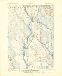
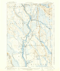
1917 Map of Passadumkeag
USGS Topo · Published 1945About this map
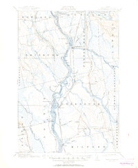
The Penobscot River serves as the central artery for this Penobscot County landscape, defining the boundaries and industrial character of several towns during the early twentieth century. From Howland at the confluence of the Piscataquis River to the southern reach near Costigan, the river is dotted with large islands including Olamon Island and Sugar Island. The presence of the Maine Central Railroad and the Bangor and Aroostook Railroad illustrates a dual dependence on rail and water for moving lumber and goods. Small rural settlements and educational landmarks such as the Edinburg School and Scott Corners School are scattered along the western and eastern shores. In the northeastern corner, the deep waters of Cold Stream Pond contrast with the numerous marshes and brooks like Sunkhaze Brook and Olamon Stream that feed into the Penobscot.
Find a feature on this map
91 named features on this map. Tap any name to fly to it.
Don’t see what you’re looking for? This feature index may not catch every label — zoom into the map to look around manually.
Map Details
Editions of this 1917 Passadumkeag Map
7 editions found
Other maps of this area

1902 · Orono
USGS Topo · 1:62,500

1902 · Bangor
USGS Topo · 1:62,500

1917 · Passadumkeag
USGS Topo · 1:62,500

1920 · Winn
USGS Topo · 1:62,500

1929 · Great Pond
USGS Topo · 1:48,000

1931 · Saponac
USGS Topo · 1:48,000

1932 · Great Pond
USGS Topo · 1:62,500

1933 · Boyd Lake
USGS Topo · 1:62,500

1934 · Saponac
USGS Topo · 1:62,500

1942 · Lincoln
USGS Topo · 1:62,500