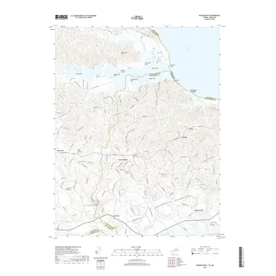
2019 Map of Passapatanzy
USGS Topo · Published 2019About this map
Passapatanzy and White Oak anchor the landscape of this peninsula where the Potomac River and Potomac Creek converge. The topography is defined by significant wetlands like the Black Swamp and intricate coastal features including Boykins Island, Old Landing Point, and Whipsawasons Point. This region reflects a long history of local settlement, evidenced by a high density of rural cemeteries such as Bethel Baptist Church Cem and Bethlehem Cem.
Find a feature on this map
55 named features on this map. Tap any name to fly to it.
Don’t see what you’re looking for? This feature index may not catch every label — zoom into the map to look around manually.
Map Details
Editions of this 2019 Passapatanzy Map
This is the sole edition of this map. No revisions or reprints were ever made.
Other maps of this area

1889 · Fredericksburg
USGS Topo · 1:125,000

1892 · Fredericksburg
USGS Topo · 1:125,000

1894 · Fredericksburg
USGS Topo · 1:125,000

1913 · Nanjemoy
USGS Topo · 1:62,500

1926 · Stafford
USGS Topo · 1:62,500

1931 · Stafford
USGS Topo · 1:62,500

1942 · Guinea
USGS Topo · 1:31,680

1942 · Port Royal
USGS Topo · 1:31,680

1942 · Rappahannock Academy
USGS Topo · 1:31,680
1943 · Fredericksburg
USGS Topo · 1:24,000