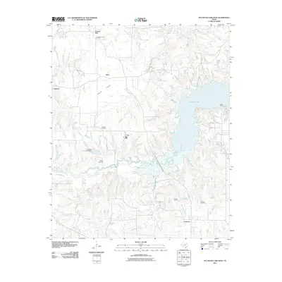
2011 Map of Pat Mayse Lake West
USGS Topo · Published 2011About this map
Pat Mayse Lake defines the eastern edge of this landscape, its waters reaching into the surrounding terrain via Sumner Branch and Sand Branch. The topography is a mix of creek-fed bottoms and open areas like Round Prairie, with small settlements such as Belk, Ragtown, and Emberson dotting the road network. These communities are anchored by several local burial grounds, including Community Hall Cemetery and Post Oak Cemetery, which provide critical points of interest for genealogical research in this part of Lamar County.
Find a feature on this map
20 named features on this map. Tap any name to fly to it.
Don’t see what you’re looking for? This feature index may not catch every label — zoom into the map to look around manually.
Map Details
Editions of this 2011 Pat Mayse Lake West Map
This is the sole edition of this map. No revisions or reprints were ever made.
Other maps of this area

1903 · Paris
USGS Topo · 1:125,000

1947 · Honey Grove
USGS Topo · 1:62,500

1948 · Grant
USGS Topo · 1:62,500

1948 · Paris
USGS Topo · 1:62,500

1948 · Direct
USGS Topo · 1:62,500

1949 · Direct
USGS Topo · 1:62,500

1949 · Honey Grove
USGS Topo · 1:62,500

1949 · Grant
USGS Topo · 1:62,500

1949 · Paris
USGS Topo · 1:62,500

1953 · Texarkana
USGS Topo · 1:250,000