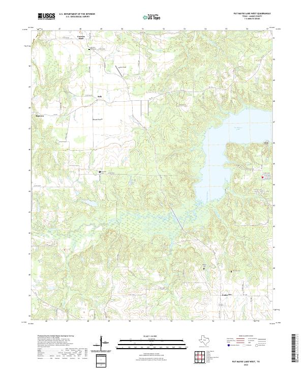
2022 Map of Pat Mayse Lake West
USGS Topo · Published 2022About this map
The western reaches of Pat Mayse Lake dominate this portion of Lamar County, where the sprawling water body meets the winding course of Sanders Creek and its many tributaries. The surrounding landscape is a network of small, established rural communities and family-named landmarks that speak to the agricultural heritage of North Texas. Small settlements like Garretts Bluff, Belk, and Emberson are connected by a web of farm-to-market roads and county lanes, such as Razor Rd and Clay Bluff Rd.
Find a feature on this map
53 named features on this map. Tap any name to fly to it.
Don’t see what you’re looking for? This feature index may not catch every label — zoom into the map to look around manually.
Map Details
Editions of this 2022 Pat Mayse Lake West Map
This is the sole edition of this map. No revisions or reprints were ever made.
Other maps of this area

1903 · Paris
USGS Topo · 1:125,000

1947 · Honey Grove
USGS Topo · 1:62,500

1948 · Grant
USGS Topo · 1:62,500

1948 · Paris
USGS Topo · 1:62,500

1948 · Direct
USGS Topo · 1:62,500

1949 · Direct
USGS Topo · 1:62,500

1949 · Honey Grove
USGS Topo · 1:62,500

1949 · Grant
USGS Topo · 1:62,500

1949 · Paris
USGS Topo · 1:62,500

1953 · Texarkana
USGS Topo · 1:250,000