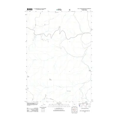
2012 Map of Pat O' Hara Mountain
USGS Topo · Published 2012About this map
Pat O'Hara Mountain dominates this portion of Park County, serving as the high point for a drainage network that defines the local topography. This 2012 survey illustrates a landscape primarily shaped by water and elevation, where the Pat O'Hara Basin collects runoff that feeds into Pat O'Hara Cr and its various tributaries. The northern reaches are marked by the Natural Corral and the headwaters of Paint Cr, while the eastern terrain drops toward the distinct geological formation of Oxyoke Canyon. Human movement through this high country is limited to a few specific corridors, most notably Monument Hill Rd in the south. The arrangement of seasonal waterways like the Dry Fork and Blaine Cr suggests a region defined by sharp changes in relief and spring snowmelt, typical of the Wyoming high country.
Find a feature on this map
12 named features on this map. Tap any name to fly to it.
Don’t see what you’re looking for? This feature index may not catch every label — zoom into the map to look around manually.
Map Details
Editions of this 2012 Pat O' Hara Mountain Map
This is the sole edition of this map. No revisions or reprints were ever made.
Other maps of this area

1949 · Pat O'Hara Mountain
USGS Topo · 1:62,500

1949 · Cody
USGS Topo · 1:62,500

1950 · Clark
USGS Topo · 1:62,500

1950 · Deep Lake
USGS Topo · 1:62,500

1951 · Cody
USGS Topo · 1:62,500

1955 · Cody
USGS Topo · 1:250,000

1958 · Cody
USGS Topo · 1:250,000

1962 · Cody
USGS Topo · 1:250,000

1980 · Cody
USGS Topo · 1:100,000
1987 · Jim Mountain
USGS Topo · 1:24,000