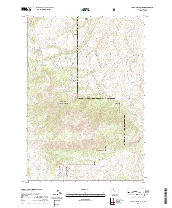
2021 Map of Pat O' Hara Mountain
USGS Topo · Published 2021About this map
Pat O'Hara Mtn anchors this high-elevation landscape in Park County, where the topography transitions from the dramatic Pat O'Hara Basin to the deep recesses of Oxyoke Canyon. The map details a complex drainage system including Paint Cr, Blaine Cr, and the Dry Fork, which carve through the high country. Human access is marked by the winding routes of Crandall Rd and Dead Indian Hill Rd, as well as the remote Pat O'Hara Trl that traverses the western slopes. A unique geological or topographic curiosity, the Natural Corral, sits near the northern boundary. This modern survey provides an intricate view of how modern forest roads and historical trails navigate the rugged barriers of the Absaroka Range foothills, defining the movement of water and travel in this corner of Wyoming.
Find a feature on this map
17 named features on this map. Tap any name to fly to it.
Don’t see what you’re looking for? This feature index may not catch every label — zoom into the map to look around manually.
Map Details
Editions of this 2021 Pat O' Hara Mountain Map
This is the sole edition of this map. No revisions or reprints were ever made.
Other maps of this area

1949 · Pat O'Hara Mountain
USGS Topo · 1:62,500

1949 · Cody
USGS Topo · 1:62,500

1950 · Clark
USGS Topo · 1:62,500

1950 · Deep Lake
USGS Topo · 1:62,500

1951 · Cody
USGS Topo · 1:62,500

1955 · Cody
USGS Topo · 1:250,000

1958 · Cody
USGS Topo · 1:250,000

1962 · Cody
USGS Topo · 1:250,000

1980 · Cody
USGS Topo · 1:100,000
1987 · Jim Mountain
USGS Topo · 1:24,000