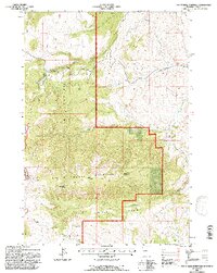
1991 Map of Pat O' Hara Mountain
USGS Topo · Published 1997About this map
Shoshone National Forest defines this high-elevation landscape in the early 1990s, where the massive profile of Pat O'Hara Mountain dominates the terrain. This revised Forest Service study documents a transition from managed forest land to the protected reaches of the North Absaroka Wilderness in the west, marked by significant landmarks like Pat O'Hara Peak and Mooncrest. The map reveals a complex drainage network where Paint Creek, Blaine Creek, and the Dry Fork carve deep through the uplands. The presence of the Joseph Scenic Highway and various 4WD tracks suggests the balance between recreational access and the rugged isolation of features like the Natural Corral and the sprawling O'Hara Basin. Geologically-minded researchers will note the steep descent into Oxyoke Canyon and the distinct boundaries of the Clarks Fork Wapiti District.
Find a feature on this map
21 named features on this map. Tap any name to fly to it.
Don’t see what you’re looking for? This feature index may not catch every label — zoom into the map to look around manually.
Map Details
Editions of this 1991 Pat O' Hara Mountain Map
This is the sole edition of this map. No revisions or reprints were ever made.
Other maps of this area

1949 · Pat O'Hara Mountain
USGS Topo · 1:62,500

1949 · Cody
USGS Topo · 1:62,500

1950 · Clark
USGS Topo · 1:62,500

1950 · Deep Lake
USGS Topo · 1:62,500

1951 · Cody
USGS Topo · 1:62,500

1955 · Cody
USGS Topo · 1:250,000

1958 · Cody
USGS Topo · 1:250,000

1962 · Cody
USGS Topo · 1:250,000

1980 · Cody
USGS Topo · 1:100,000
1987 · Jim Mountain
USGS Topo · 1:24,000