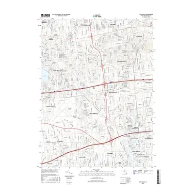
2016 Map of Patchogue
USGS Topo · Published 2016About this map
Lake Ronkonkoma sits at the heart of this central Suffolk County landscape, serving as a geographic anchor for the surrounding communities of Stony Brook, Lake Grove, and Ronkonkoma. The map reveals a densely developed suburban pattern shaped by major transit corridors, including the Long Island Expressway and the Long Island Rail Road. This era shows the significant footprint of Long Island Mac Arthur Airport and the Suffolk County Community College campus, reflecting the region's mid-century role as a residential and educational hub.
Find a feature on this map
58 named features on this map. Tap any name to fly to it.
Don’t see what you’re looking for? This feature index may not catch every label — zoom into the map to look around manually.
Map Details
Editions of this 2016 Patchogue Map
This is the sole edition of this map. No revisions or reprints were ever made.
Other maps of this area

1902 · Setauket
USGS Topo · 1:62,500

1902 · Fire Island
USGS Topo · 1:62,500

1903 · Fire Island
USGS Topo · 1:62,500

1904 · Setauket
USGS Topo · 1:62,500

1904 · Islip
USGS Topo · 1:125,000

1904 · Moriches
USGS Topo · 1:62,500

1919 · Setauket
USGS Topo · 1:62,500

1942 · Islip
USGS Topo · 1:125,000

1944 · Bay Shore East
USGS Topo · 1:24,000
1947 · St James
USGS Topo · 1:24,000