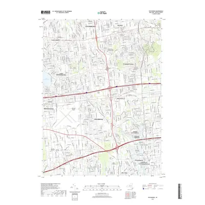
2019 Map of Patchogue
USGS Topo · Published 2019About this map
Patchogue and the surrounding central Suffolk County landscape appear here in a period of intense suburban connectivity, defined by the dense network of roadways like Middle Country Rd and the Long Island railroad. To the north, the terrain is shaped by the glacial remnants of Glacier Ridge and the prominent Lake Ronkonkoma, while the southern margin reaches the edges of the Fire Island National Seashore. The map preserves a dense record of local heritage through its numerous burial grounds, including the Old Coram Cem, Cenacle Convent Graveyard, and the Newton Cem. Aviation interests are represented by the sprawling Long Island MacArthur Airport and the smaller Bayport Aerodrome. From North Patchogue down to the shoreline at Blue Point, the map captures the transition from residential developments to the creeks and lakes, such as Canaan Lake and West Lake, that drain toward the Great South Bay.
Find a feature on this map
51 named features on this map. Tap any name to fly to it.
Don’t see what you’re looking for? This feature index may not catch every label — zoom into the map to look around manually.
Map Details
Editions of this 2019 Patchogue Map
This is the sole edition of this map. No revisions or reprints were ever made.
Other maps of this area

1902 · Setauket
USGS Topo · 1:62,500

1902 · Fire Island
USGS Topo · 1:62,500

1903 · Fire Island
USGS Topo · 1:62,500

1904 · Setauket
USGS Topo · 1:62,500

1904 · Islip
USGS Topo · 1:125,000

1904 · Moriches
USGS Topo · 1:62,500

1919 · Setauket
USGS Topo · 1:62,500

1942 · Islip
USGS Topo · 1:125,000

1944 · Bay Shore East
USGS Topo · 1:24,000
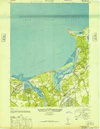
1947 · St James
USGS Topo · 1:24,000