
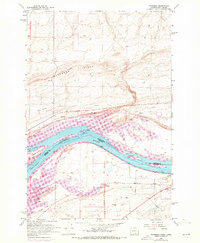
1962 Map of Paterson
USGS Topo · Published 1963About this map
The Columbia River serves as the dominant geographic and jurisdictional boundary on this 1962 survey, separating the states of Washington and Oregon. This stretch of the river is characterized by several large islands, including Cooks Island, Blalock Island, and Island No 18, which sit between the North Channel and South Channel. The settlement of Paterson and the nearby Paterson Junction are positioned as key transit points along the Spokane Portland and Seattle railroad.
Find a feature on this map
27 named features on this map. Tap any name to fly to it.
Don’t see what you’re looking for? This feature index may not catch every label — zoom into the map to look around manually.
Map Details
Editions of this 1962 Paterson Map
2 editions found
Other maps of this area

1906 · Blalock Island
USGS Topo · 1:125,000

1908 · Blalock Island
USGS Topo · 1:125,000

1908 · Umatilla
USGS Topo · 1:125,000

1915 · Prosser
USGS Topo · 1:125,000

1917 · Pasco
USGS Topo · 1:125,000

1917 · Prosser
USGS Topo · 1:125,000

1953 · Pendleton
USGS Topo · 1:250,000

1953 · Walla Walla
USGS Topo · 1:250,000

1956 · Pendleton
USGS Topo · 1:250,000

1958 · Walla Walla
USGS Topo · 1:250,000