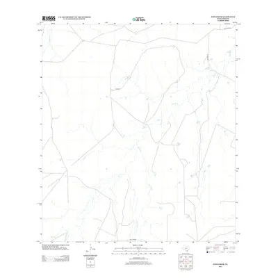
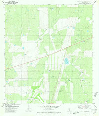
2013 Map of Pato Creek
USGS Topo · Published 2013About this map
Hirsh Ranch sits in a landscape of dry creek beds and isolated ranch roads in this part of Webb County. The area is defined by its seasonal drainage systems, including the namesake Pato Cr and the extensive network of Becerra Cr which dominates the central and eastern portions of the quadrangle. Transport through this brushland environment relies on a few named corridors such as Gallaghan Rd and Becerras Rd. These routes and watercourses, such as Carrizitos Cr and San Carlos Cr, suggest a land primarily used for large-scale ranching operations typical of South Texas. The map illustrates the sparse infrastructure and remote character of the region during the early twenty-first century, showing how modern ranching life continues to follow the natural contours of the local watershed.
Find a feature on this map
9 named features on this map. Tap any name to fly to it.
Don’t see what you’re looking for? This feature index may not catch every label — zoom into the map to look around manually.
Map Details
Editions of this 2013 Pato Creek Map
This is the sole edition of this map. No revisions or reprints were ever made.
Other maps of this area

1937 · Aguilete Creek
USGS Topo · 1:62,500

1956 · Becerra
USGS Topo · 1:62,500

1956 · Laredo East
USGS Topo · 1:62,500

1956 · Webb
USGS Topo · 1:62,500

1956 · Laredo
USGS Topo · 1:250,000

1965 · Cibolo Ranch
USGS Topo · 1:24,000
1980 · Alamito Creek
USGS Topo · 1:24,000
1980 · Callaghan Ranch SE
USGS Topo · 1:24,000
1980 · Venado Creek West
USGS Topo · 1:24,000
1980 · Piedra Parada Ranch
USGS Topo · 1:24,000