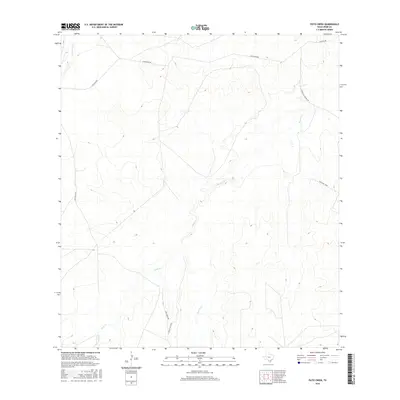
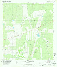
2016 Map of Pato Creek
USGS Topo · Published 2016About this map
Becerra Cr and Mule Cr define the drainage patterns across this section of Webb County, where seasonal watercourses have carved intricate relief into the South Texas brush country. The landscape is characterized by a network of ranch roads and remote tracks, such as Callaghan Rd and Becerra Rd, which connect isolated parcels of land. The survey details the convergence of several small tributaries, including Carrizitos Cr in the northwest and San Carlos Cr to the southwest.
Find a feature on this map
10 named features on this map. Tap any name to fly to it.
Don’t see what you’re looking for? This feature index may not catch every label — zoom into the map to look around manually.
Map Details
Editions of this 2016 Pato Creek Map
This is the sole edition of this map. No revisions or reprints were ever made.
Other maps of this area

1937 · Aguilete Creek
USGS Topo · 1:62,500

1956 · Becerra
USGS Topo · 1:62,500

1956 · Laredo East
USGS Topo · 1:62,500

1956 · Webb
USGS Topo · 1:62,500

1956 · Laredo
USGS Topo · 1:250,000

1965 · Cibolo Ranch
USGS Topo · 1:24,000
1980 · Alamito Creek
USGS Topo · 1:24,000
1980 · Callaghan Ranch SE
USGS Topo · 1:24,000
1980 · Venado Creek West
USGS Topo · 1:24,000
1980 · Piedra Parada Ranch
USGS Topo · 1:24,000