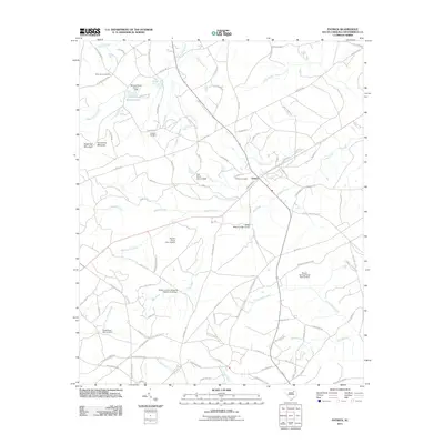
2011 Map of Patrick
USGS Topo · Published 2011About this map
The town of Patrick serves as the central hub of this South Carolina landscape, situated where the terrain begins its transition toward distinctive elevations like Sugarloaf Mountain and Horseshoe Mountain. The map reveals a complex network of water management, evidenced by numerous named impoundments including McLean Pond, Pate Pond, and Wilkes Millpond Dam D-3211. These water features, alongside drainages like Deadman Branch and Juniper Creek, define the rural character of Chesterfield County. Local family and community history is preserved through the locations of Saint Johns Cemetery, Huggins Cemetery, and Patrick Cemetery. Long-established transit routes, most notably the historic Old Wire Rd, cut across the quadrangle, linking the small settlement to the surrounding countryside and illustrating the area's continued reliance on these traditional corridors into the twenty-first century.
Find a feature on this map
107 named features on this map. Tap any name to fly to it.
Don’t see what you’re looking for? This feature index may not catch every label — zoom into the map to look around manually.
Map Details
Editions of this 2011 Patrick Map
This is the sole edition of this map. No revisions or reprints were ever made.
Other maps of this area

1941 · Spartanburg
USGS Topo · 1:250,000

1942 · Rockingham
USGS Topo · 1:125,000

1953 · Florence
USGS Topo · 1:250,000

1953 · Spartanburg
USGS Topo · 1:250,000

1954 · Florence
USGS Topo · 1:250,000

1960 · Spartanburg
USGS Topo · 1:250,000

1963 · Spartanburg
USGS Topo · 1:250,000

1963 · Dovesville
USGS Topo · 1:24,000

1964 · Spartanburg
USGS Topo · 1:250,000

1968 · Chesterfield
USGS Topo · 1:24,000