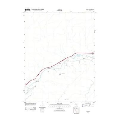
2011 Map of Patrick
USGS Topo · Published 2011About this map
The Truckee River corridor defines the geography of this northern Nevada landscape, serving as the primary artery for both transportation and water. Modern transit infrastructure is established via the Patrick Interchange and Clark Interchange, facilitating movement between small settlements like Patrick and Wunotoo. This 2011 survey captures a transition from traditional agricultural and ranching land uses, evidenced by the 102 Ranch, to a more industrial and residential layout indicated by roads like Waltham Way. The southern terrain rises toward the prominent height of Clark Mountain, while deep geological features such as Chalk Bluff Canyon and Giants Throne Canyon break the desert floor. Water resources are managed through features like Tracy Pond, which alongside the river, support the area's ongoing development east of the Reno-Sparks metropolitan area.
Find a feature on this map
19 named features on this map. Tap any name to fly to it.
Don’t see what you’re looking for? This feature index may not catch every label — zoom into the map to look around manually.
Map Details
Editions of this 2011 Patrick Map
This is the sole edition of this map. No revisions or reprints were ever made.
Other maps of this area

1890 · Wadsworth
USGS Topo · 1:125,000

1891 · Carson
USGS Topo · 1:125,000

1891 · Wabuska
USGS Topo · 1:125,000

1891 · Reno
USGS Topo · 1:125,000

1892 · Wadsworth
USGS Topo · 1:125,000

1893 · Carson
USGS Topo · 1:125,000

1893 · Reno
USGS Topo · 1:125,000

1894 · Wadsworth
USGS Topo · 1:125,000

1894 · Wabuska
USGS Topo · 1:125,000

1950 · Virginia City
USGS Topo · 1:62,500