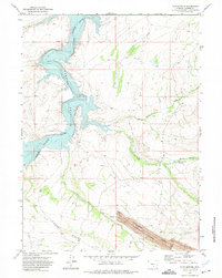
1971 Map of Pats Bottom
USGS Topo · Published 1975About this map
Monument Seminoe Mine Ridge anchors the southeastern landscape of this 1971 survey, where the rugged topography of Carbon County meets the industrial legacy of Wyoming mining. The North Platte River flows into the expansive Seminoe Reservoir, a central water body that reshaped the local geography. Significant landforms like Edson Ridge and the Saint Marys area provide a framework for the drainage systems, including Dry Ditch and the aptly named Pats Bottom along the reservoir's edge. This map reveals a transition between hydraulic infrastructure and resource extraction, evidenced by scattered Mines and the Steel Granary Reservoir. The U. S. Bureau of Reclamation's influence is clear, as the map documents the reservoir's high-water mark and the surrounding network of ditches and natural springs that sustained life and industry in this arid high-plains environment.
Find a feature on this map
13 named features on this map. Tap any name to fly to it.
Don’t see what you’re looking for? This feature index may not catch every label — zoom into the map to look around manually.
Map Details
Editions of this 1971 Pats Bottom Map
2 editions found
Other maps of this area

1893 · Fort Steele
USGS Topo · 1:125,000

1914 · Hanna
USGS Topo · 1:62,500

1914 · Walcott
USGS Topo · 1:62,500

1953 · Seminoe Dam SW
USGS Topo · 1:24,000

1953 · Seminoe Dam SE
USGS Topo · 1:24,000

1953 · Schneider Ridge
USGS Topo · 1:24,000

1954 · Rawlins
USGS Topo · 1:250,000

1955 · Casper
USGS Topo · 1:250,000

1958 · Rawlins
USGS Topo · 1:250,000

1958 · Casper
USGS Topo · 1:250,000