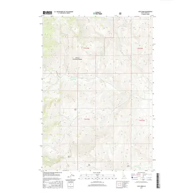
2017 Map of Pats Creek
USGS Topo · Published 2017About this map
Challis National Forest dominates this section of the central Idaho mountains, characterized by a complex network of high-elevation drainages and steep gulches. The landscape is primarily defined by its water system, where Challis Creek and White Valley Creek converge, eventually drawing from higher reaches like Pats Creek and Eddy Creek. Evidence of human movement through this backcountry is visible along Twin Peaks Rd, which provides access to the higher elevations near Jeffs Flats. In the southern portion of the survey, the terrain transitions into a series of named landforms such as Big Hill Gulch and Klug Gulch, alongside the curiously named Slab Barn Lake. The map illustrates the 21st-century management of these public lands, showing the intersections of Forest Service interests and the natural topography of Custer County.
Find a feature on this map
21 named features on this map. Tap any name to fly to it.
Don’t see what you’re looking for? This feature index may not catch every label — zoom into the map to look around manually.
Map Details
Editions of this 2017 Pats Creek Map
This is the sole edition of this map. No revisions or reprints were ever made.
Other maps of this area

1929 · Bayhorse
USGS Topo · 1:125,000

1956 · Challis
USGS Topo · 1:62,500

1956 · Twin Peaks
USGS Topo · 1:62,500

1957 · Challis
USGS Topo · 1:250,000

1960 · Challis
USGS Topo · 1:250,000

1963 · Challis
USGS Topo · 1:250,000

1963 · Bayhorse Lake
USGS Topo · 1:24,000

1963 · Bayhorse
USGS Topo · 1:24,000

1963 · Clayton
USGS Topo · 1:62,500

1963 · Lone Pine Peak
USGS Topo · 1:62,500