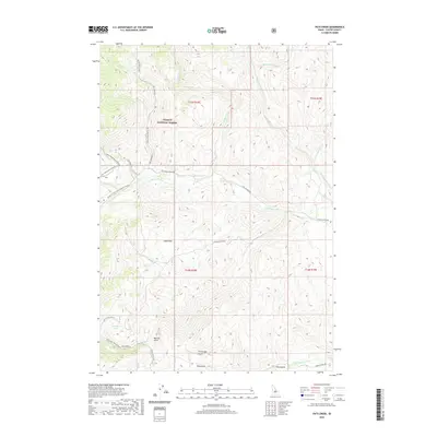
2020 Map of Pats Creek
USGS Topo · Published 2020About this map
Challis National Forest dominates this high-altitude terrain in Custer County, Idaho, where a network of seasonal routes and forest service roads provides access to the mountainous interior. The landscape is defined by deep drainage systems and named gulches including Big Hill Gulch, Cartwright Gulch, and Klug Gulch, reflecting the topographic character that long influenced local movement. Central to the map, Jeffs Flats sits as a prominent high-ground feature, while Slab Barn Lake offers a rare body of standing water among the numerous seasonal creeks like Pats Creek and Challis Creek. Historically significant corridors such as the Custer Motor Way and Mill Creek Road traverse the southern portion of the sheet, tracing the pathways of early 20th-century development and access to the region's interior resources.
Find a feature on this map
34 named features on this map. Tap any name to fly to it.
Don’t see what you’re looking for? This feature index may not catch every label — zoom into the map to look around manually.
Map Details
Editions of this 2020 Pats Creek Map
This is the sole edition of this map. No revisions or reprints were ever made.
Other maps of this area

1929 · Bayhorse
USGS Topo · 1:125,000

1956 · Challis
USGS Topo · 1:62,500

1956 · Twin Peaks
USGS Topo · 1:62,500

1957 · Challis
USGS Topo · 1:250,000

1960 · Challis
USGS Topo · 1:250,000

1963 · Challis
USGS Topo · 1:250,000

1963 · Bayhorse Lake
USGS Topo · 1:24,000

1963 · Bayhorse
USGS Topo · 1:24,000

1963 · Clayton
USGS Topo · 1:62,500

1963 · Lone Pine Peak
USGS Topo · 1:62,500