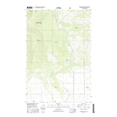
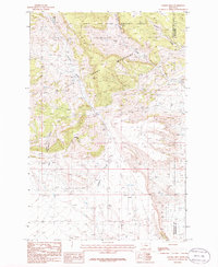
2017 Map of Patterson Canyon
USGS Topo · Published 2017About this map
The Lewis & Clark National Forest anchors the northwestern portion of this 2017 study, where the high ridges of the Big Snowy Mountains and Little Snowy Mountains converge. This transition from the forested heights of the Snowy ranges down into the coulee and canyon country of Golden Valley County reveals a landscape defined by dramatic elevation changes. Arid drainages such as Horsethief Canyon and Ashley Coulee carve through the foothills, while McLean Lake and the S Fork Flatwillow Cr provide essential water sources in an otherwise high-prairie environment. The road network, including Red Hill Rd and Metzger Rd, follows the natural contours of the land, tracing the path of least resistance through the breaks and along the base of Red Hill.
Find a feature on this map
21 named features on this map. Tap any name to fly to it.
Don’t see what you’re looking for? This feature index may not catch every label — zoom into the map to look around manually.
Map Details
Editions of this 2017 Patterson Canyon Map
This is the sole edition of this map. No revisions or reprints were ever made.
Other maps of this area

1889 · Big Snowy Mountain
USGS Topo · 1:250,000

1893 · Big Snowy Mountain
USGS Topo · 1:250,000

1954 · Roundup
USGS Topo · 1:250,000

1958 · Roundup
USGS Topo · 1:250,000

1970 · South Bench
USGS Topo · 1:24,000
1970 · Alaska Bench
USGS Topo · 1:24,000
1970 · Half Moon Canyon
USGS Topo · 1:24,000

1986 · Patterson Canyon
USGS Topo · 1:24,000
1986 · Rothiemay
USGS Topo · 1:24,000
1986 · Sahara Hill
USGS Topo · 1:24,000